
Rakesh Prasad
▲ 1714 contribution
Pilot BallotBoxIndia is in pilot mode. Rankings, metrics and content are generated by an experimental backend that uses AI, may be incomplete or inaccurate, and are for exploration only. Verify against the original or an equivalent authoritative source before any decision. Reference facts (e.g. Census 2011) may be outdated.
ABOUT – Ghaziabad, which is also known as GATEWAY OF UP because it acts as the main entrance of Uttar- Pradesh. The district Ghaziabad was founded in 1740 by the emperor, Ghazi-ud-din. He named this district on his own name Ghaziuddinnagar. After opening the railway line in this district, Ghaziuddinnagar has become Ghaziabad. This district is main way to UP. This is not only the part of UP but it is also a part of National capita
BallotBoxIndia treats a district's development like a shared fund, and every socio-political innovator — leader, NGO, business, expert, journalist, activist — like a contributor whose impact we try to measure. The scores here are an experiment to tell apart what an innovator actually moved (नेता का हाथ · their real contribution) from what circumstance carried (हालात · the wave).
Parties, leaders and experts active in this district. Attribution is estimated from public activity — not an official record.


Recent posts and research updates from leaders and agencies active in this district.
Ward-level and district projects where problems are being worked. Contribution accrues to whoever moves each milestone.

Ghaziabad,
which is also known as GATEWAY OF UP because it acts as the main
entrance of Uttar- Pradesh. The district
Ghaziabad was founded in 1740 by the emperor, Ghazi-ud-din. He named this district
on his own name Ghaziuddinnagar.
After
opening the railway line in this district, Ghaziuddinnagar has become Ghaziabad.
This district is main way to UP. This is not only the part of UP but it is also
a part of National capital. It is a large and planned industrial district,
which is also industrial and educational center of Western Uttar-Pradesh.
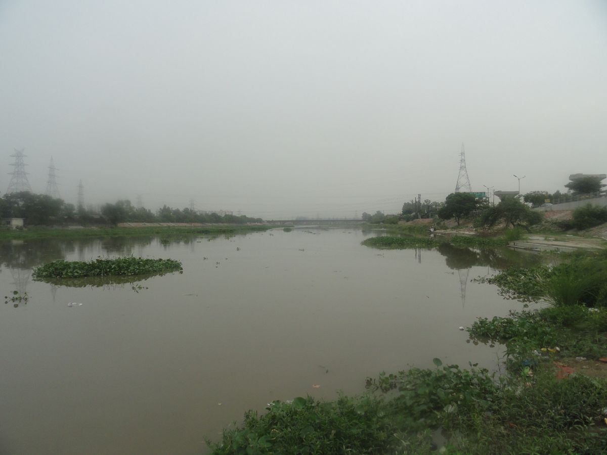
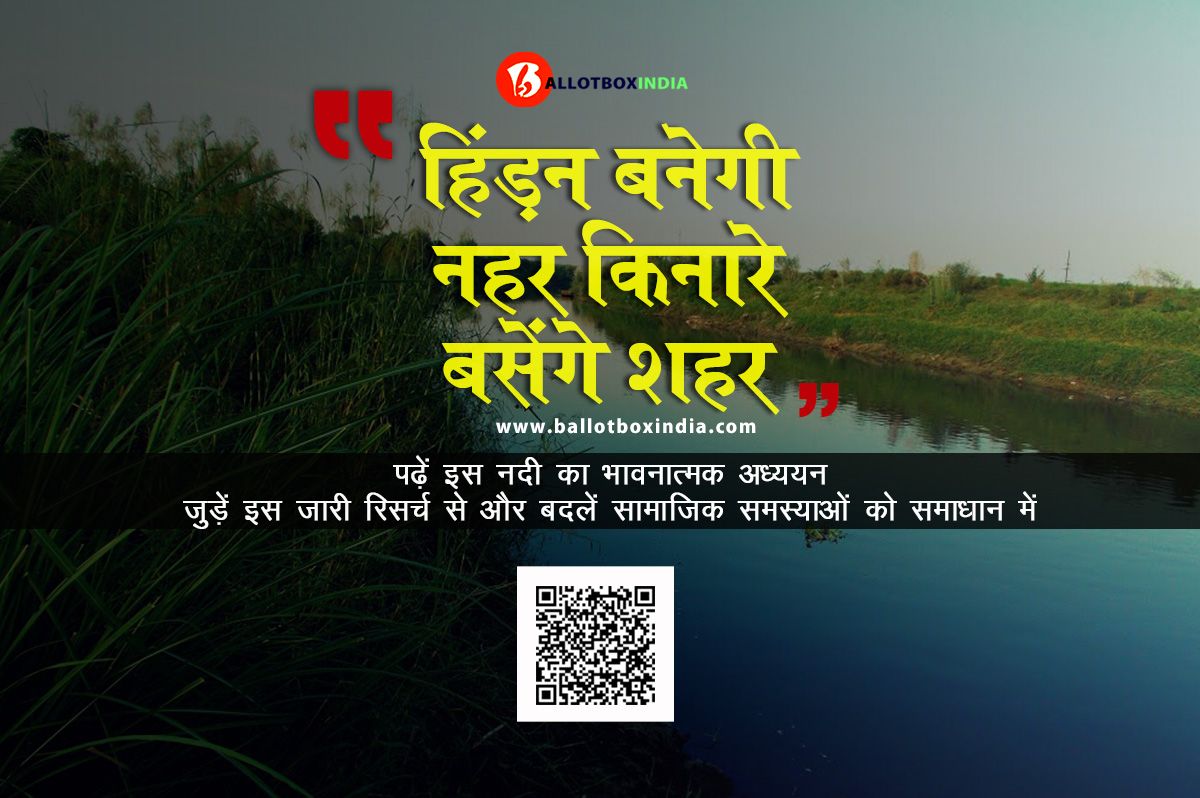
The
district is situated in upper Gangetic plain, the district is separated by the
Hindon river namely trans-hindon and cis-hindon on east and west side of district
respectively. In a survey which is conducted by Mayors Foundation where they
tell that in development Ghaziabad is at second fastest growing district in
world.
The district of
Ghaziabad was founded in AD 1740 by Wazir Ghazi-ud-din, who named it
Ghaziuddinnagar after himself. During the Mughal period, Ghaziabad and
especially on the banks of the Hindon in Ghaziabad, remained a picnic
spot for the Mughal royal family. An encounter between the freedom fighters and a
small British force also took place here in May, 1857, in which the former were
defeated while trying to hold the Hindon.
The name
"Ghaziuddinnagar" was shortened to its present form, i.e.
"Ghaziabad" with the opening of the Railways in 1864 Ghaziabad became
the junction of the East Indian Railway and Sind, Punjab and Delhi Railway. Ghaziabad was associated with
the Indian independence movement from the Indian rebellion of
1857. On
14 November 1976 Ghaziabad is carved out of Meerut district, Ghaziabad, along with Meerut and Bulandsahar, remained one of the
three Munsifis of the District, under the Meerut Civil Judgeship during most
periods of the British raj.
In AD 1313, the
entire region including present day Ghaziabad became a huge battlefield,
when Taimur laid siege on the area during Mohammad Bin Tuglaq’s reign. Before November 14,1976 district was the
tehsil of Meerut. On the birth anniversary of first of PM of India Pt.
Jawaharlal Nehru, CM Mr. N.D Tiwari declared Ghaziabad as a District. On 31 August 1994 Ghaziabad became Municipal Corporation.
Mohan nagar shows
that civilization was developed here in 2500 B.C
There is a war
between Sir General Lake and the Royal Maratha army were fought in bank of
river Hindon in 1803. Seven war are fought in this region and the most
important war is fought on 30 &31 may 1857 with British this was the first
war for independence and it brought Ghaziabad much of its glory.
There is a small Pooth
village in Garh Mukteshwar block, which is associated with Mahabharat period
and near this there is Ahar region which was supposed to be Pandava’s Nag yagya
site. There is a Loni fort which is from Ramayana period and is associated with
Lavanasura.
Each
and every place has some difference in their geography. Total area of the district
is 133.3 km2 (51.5 sq mi) Ghaziabad lies on the GT road about a mile east of the
Hindon river in Lat. 280 40'North
and Long 770 25'East,
19 km. east of Delhi and 46 km. south-west of Meerut with which it is
connected by a metalled road. District is bounded by four side on Northwest by
Baghpat district, on North by Meerut district on East by Hapur district on
southwest and Southeast by Gautam Buddha nagar district, Bulandshahar district.
Bulandshahar
and Gautambudh
nagar, on the south-west
by Delhi and on the east by the newly formed
district of Hapur. The timezone of the Ghaziabad is IST (UTC+5:30). It is situated in
the middle of Ganga-Jamuna doab. Hindon is the main river flowing through the district.
Apart from this rain fed river Kali flows here. As well as Ganga canal also
flows through the district, helps in irrigation and serves drinking water to
the people of Ghaziabad.
Ghaziabad
is second largest industrial district in Uttar- Pradesh after Kanpur. There are
mainly Brahmin, Jatt, Tyagi, Gurjjar, Thakur, Yadav etc. The total area Ghaziabad (according to CENSUS 1991) was 2590.0
sq. kms, but after the formation of the new district Gautam budh Nagar, it
becomes 1933.3 sq. kms. The provisional data
derived from the 2011 census shows that Ghaziabad urban agglomeration had a
population of 2,358,525, of which males were 1,256,783 and females were
1,101,742. The literacy rate was 93.81%.
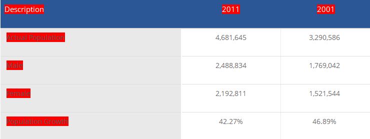
There was change of 42.27 percent in the population compared to population as per 2001. In the previous census of India 2001, Ghaziabad District recorded increase of 46.89 percent to its population compared to 1991. According to the census of 1991 the population of the district is 22,47434. There were 15,30,081 males and 12,05,397 females and there were 9,80,938 literate people in the district out of which 6,62,402 were males and 3,18,536 females. Sex ratio of this district is 881 females per 1000 males.
Ghaziabad
District population constituted 2.34 percent of total Maharashtra population.
In 2001 census, this figure for Ghaziabad District was at 1.98 percent of
Maharashtra population.
LITERACY RATE-
Average literacy rate of Ghaziabad District is 78.07%
-Male literate 85.42%
- Female literate
69.79%
As
for as the political scenario of this district is concerned it contains 5
assembly and 1 loksabha seat.
Mainly
Summer, winter, rainy seasons prevail in this district and sometimes its
weather is affected by the severe snowfall in Himalayas and Kumaon hills. Climatic condition of Ghaziabad district are
quite similar to Delhi as it is directly connected to the national capital. The monsoon arrives in Ghaziabad
during the end of the June or the first week of July and normally it rains till
october. From November to mid March, winter season lies in this district.
Originally established on the eastern side of river hindon, present sprawling development of Ghaziabad can be observed on both sides of river hindon. Hindon River is an important tributary of Yamuna River. Flowing north south, Hindon river passes through middle of the city and meets Yamuna about 35 KM south of Ghaziabad.
Apart
from Hindon there is one Ganga canal, which is basically used for irrigation
and drinking water purposes. Also rain fed river Kali flows in this district.
The Ghaziabad
economy is heavily dependent on the industries, More than 500
steel organizations in the place employs more than 25,000 people. In Ghaziabad
there the manufacturing segment employs 53% of the non-agricultural jobs in
Ghaziabad. The manufacturing industry is alone to be credited for an income, which
is eight times the income of other industries taken together.
There are other
companies except steel plant include apparel, transportation equipments, dairy
products, tobacco production, ceramics, pottery, Industrial machinery,
equipments and all sorts of electrical and electronic goods.
Other important constituents of the Ghaziabad
economy include bicycles, picture tubes, electroplating, glassware,
vegetable oil, tapestry, paint and varnish products Ghaziabad is important in
terms of the railway junction. Over a hundred long distance trains traverse the
Ghaziabad junction. Hence the railway industry too constitutes an important
part of Ghaziabad economic development.
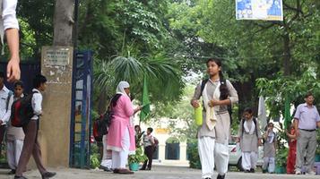
Ghaziabad Basic Education Department is an integral district of
Meerut division. There are total 4 blocks and one urban area under Ghaziabad
district. Education Officer of Ghaziabad District is Mr. Rajesh Kumar Shrivas,
who has been taking charge of this district since 2018.
Under
the basic education in the state, approximately 2,65,000 government/
non-government schools are operated in which almost all children have access to
school within a radius of 1-3 km. The basic education department has the
resolution that all children "read well, go ahead". Every student
must get eduction from first to eight class. In view of this challenge, the
Basic Education Department has developed 265 schools as Ideal Vidyalayas and
are to be completed till the remaining March, so that quality education can be
provided in resource-free schools.
AIR ROUTE -
Hindon
air force station in Ghaziabad will become the second airport for Delhi as all
flights operating on Delhi routes under the government’s regional connectivity
scheme (RCS) will land and depart from the air force station.
RAILWAY ROUTE -
The
station of the district is named as GHAZIABAD and its station code is GZB. The
station takes care of all the basic amenities of the passengers.
The
station is well-connected to a number of Indian cities. Some of the major
routes include to the places of Kanpur Central, Allahabad Jn, and New Delhi.
There are 74 weekly trains connecting Kanpur Central to Ghaziabad, 6 weekly
trains connecting Allahabad Jn to Ghaziabad, and 16 weekly trains connecting New
Delhi to Ghaziabad.
METRO ROUTE-
Delhi
extends its metro services towards Ghaziyabad. Another metro stations presents
at Vaishali, which serves that area as well as Vasundhara and Indirapuram,
and there is also a station at Kaushambi.
Government
has done so much in providing health facility to the people of Ghaziabad make
so many government hospitals.
MMG
DISTRICT HOSPITAL (Biharipura, jassipura Dasna gate, Ghaziabad)
RAILWAY
HOSPITAL (Kotwali, Madhopura, 482, Railway Station Rd,
Bazaria, Madhopura, Ghaziabad)
ESI
HOSPITAL (Medical Supdt, Block-2, Sector 2, Rajendra
Nagar, Ghaziabad)
Not
only government there are so many private hospitals like Narinder Mohan
Hospital and health center, Vasundhra Hospital etc with a good facility.
MAYOR-
ASHA SHARMA
DM-
RITU MAHESHWARI
REFRENCES
:
http://districts.nic.in/districtsdetails.php?sid=UP&disid=UP028
https://indiarailinfo.com/station/map/ghaziabad-junction-gzb/348
https://www.mapsofindia.com/ghaziabad/hospitals.html
https://www.mapsofindia.com/ghaziabad/economy/
http://dcmsme.gov.in/dips/final%20Report%20Ghaziabad.pdf
http://www.census2011.co.in/city.php
Local experts, journalists, representatives and activists — bring your action research and be credited for the milestones you move. No money changes hands here; the currency is your effort and analysis, donated to your community.
Get on the record →